In the fast-paced world of real estate, staying ahead of the competition is crucial. Advancements in technology have provided industry professionals with innovative tools to streamline their processes and provide clients with a more immersive experience. One such tool that has been making waves in the Philippines is drone technology. Drone services for real estate have transformed the way properties are marketed, surveyed, and inspected, offering numerous benefits to both agents and clients.
The Rise of Drones in Real Estate
Drones, also known as Unmanned Aerial Vehicles (UAVs), have become increasingly accessible and affordable in recent years, making them a valuable asset for real estate professionals in the Philippines. These small, remotely piloted aircraft are equipped with high-resolution cameras and advanced technology that can capture stunning aerial images and videos of properties, offering a unique perspective that was once prohibitively expensive.
Aerial Photography and Videography
One of the primary uses of drones in the real estate sector is capturing breathtaking aerial photographs and videos of properties. Drones can provide potential buyers with a bird’s-eye view of a property, showcasing its surroundings, landscape, and features. These visuals help clients better understand the property’s layout and its proximity to amenities such as schools, parks, and transportation hubs. A well-produced drone video can also create a powerful emotional connection with potential buyers, making them more likely to schedule a viewing.
Faster Property Surveys
Traditional land surveys can be time-consuming and costly. Drones can significantly expedite this process by capturing detailed aerial data and creating accurate topographic maps. This not only saves time but also reduces the margin for error in property measurements and boundary assessments.
Enhanced Property Inspections
Property inspections are a critical part of any real estate transaction. Drones can access hard-to-reach areas of a property, such as roofs and chimneys, without the need for ladders or scaffolding. This not only increases the safety of the inspection but also ensures that potential issues are identified and addressed promptly.
Benefits of Drone Services for Real Estate
The adoption of drone technology in the Philippine real estate market brings several advantages for industry professionals, property developers, and clients alike:
Improved Marketing: High-quality drone photography and videography make property listings more appealing, attracting more potential buyers.
Cost-Effective: Drones are a cost-effective alternative to traditional aerial photography and survey methods, making them accessible to a wider range of real estate professionals.
Time Savings: Drones can rapidly capture aerial data and images, reducing the time required for property surveys and inspections.
Enhanced Safety: Drones can access dangerous or hard-to-reach areas, reducing the risk of accidents during inspections.
Competitive Edge: Agents and developers who incorporate drone services into their marketing strategies gain a competitive advantage by offering a unique and immersive experience to their clients.
Regulations and Compliance
It’s important to note that the use of drones in the Philippines is regulated by the Civil Aviation Authority of the Philippines (CAAP). Anyone operating a drone for commercial purposes must obtain the necessary permits and licenses to ensure compliance with aviation laws and safety regulations. Real estate professionals should work with licensed drone operators to avoid legal issues and ensure that their drone services are conducted in a lawful and safe manner.
Drone services have revolutionized the way real estate is marketed, surveyed, and inspected in the Philippines. The stunning aerial visuals captured by drones not only enhance property listings but also provide valuable data for surveys and inspections. As the real estate industry in the Philippines continues to evolve, embracing drone technology will become increasingly essential for those looking to stay competitive and provide their clients with an immersive and informative experience. By adhering to the necessary regulations and working with licensed operators, real estate professionals can harness the full potential of drones in their business operations.
I’ve been flying drones since 2023, driven by my passion for capturing nature, real estate, and business through aerial photography and videography. When I’m not behind the drone, I focus on managing my businesses — Malachisoft.com, PinoySEO.ph, and SOVA.ph — where we help clients and students grow through web design, SEO, and virtual assistant training.

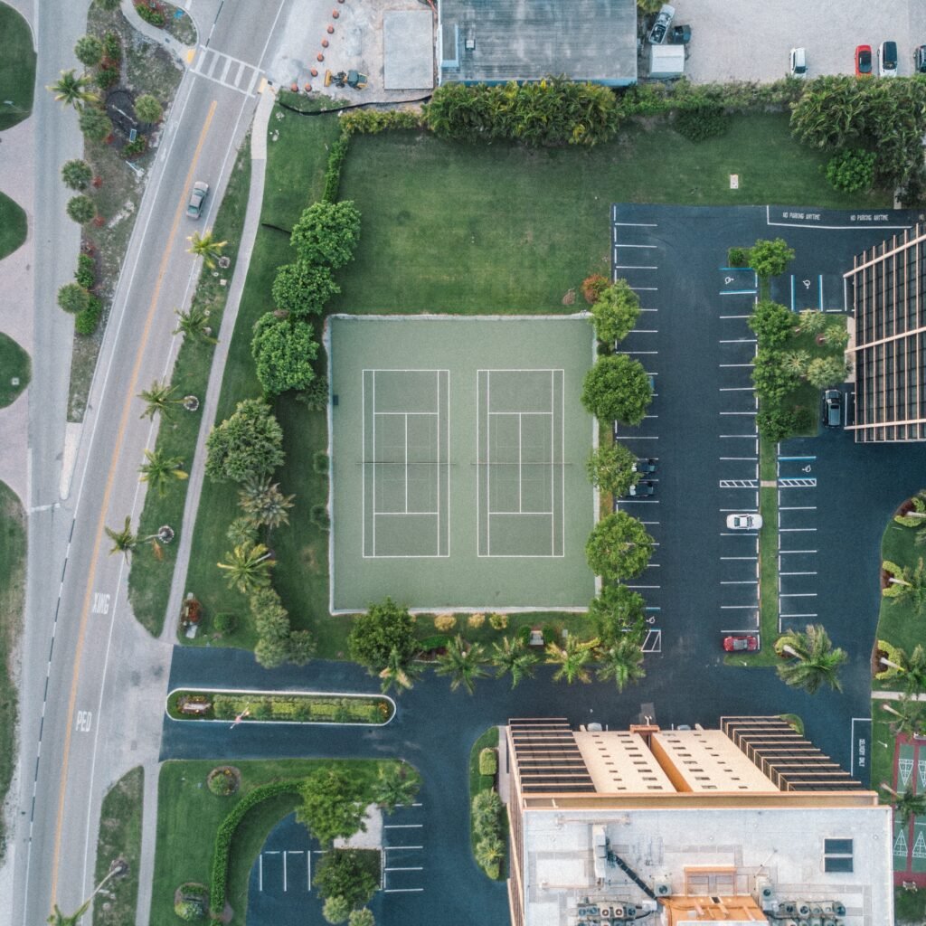





Can you possibly refer me to a drone service company for my 300 sqm lot in Quezon City presently occupied by squatters?
The whole area of the lot is 500 sqm but a security fence erected in 2003 resulted in the 300 sqm portion being part of Barangay Pansol while 200 sqm remained in subdivision territory. Squatters started occupied the excluded portion in 2003.
I am able to get a satellite image of the site using Google Maps but I am looking forward to a clearer, more defined image. The photo in the example is exactly what I need.
Thank you for whatever information/help you can provide.
Aurora H. Bumatay
Hello, I am currently in Mindanao but I will help you find a drone for hire there sa Quezon city. I will email you with updates. Thanks